Selected Projects
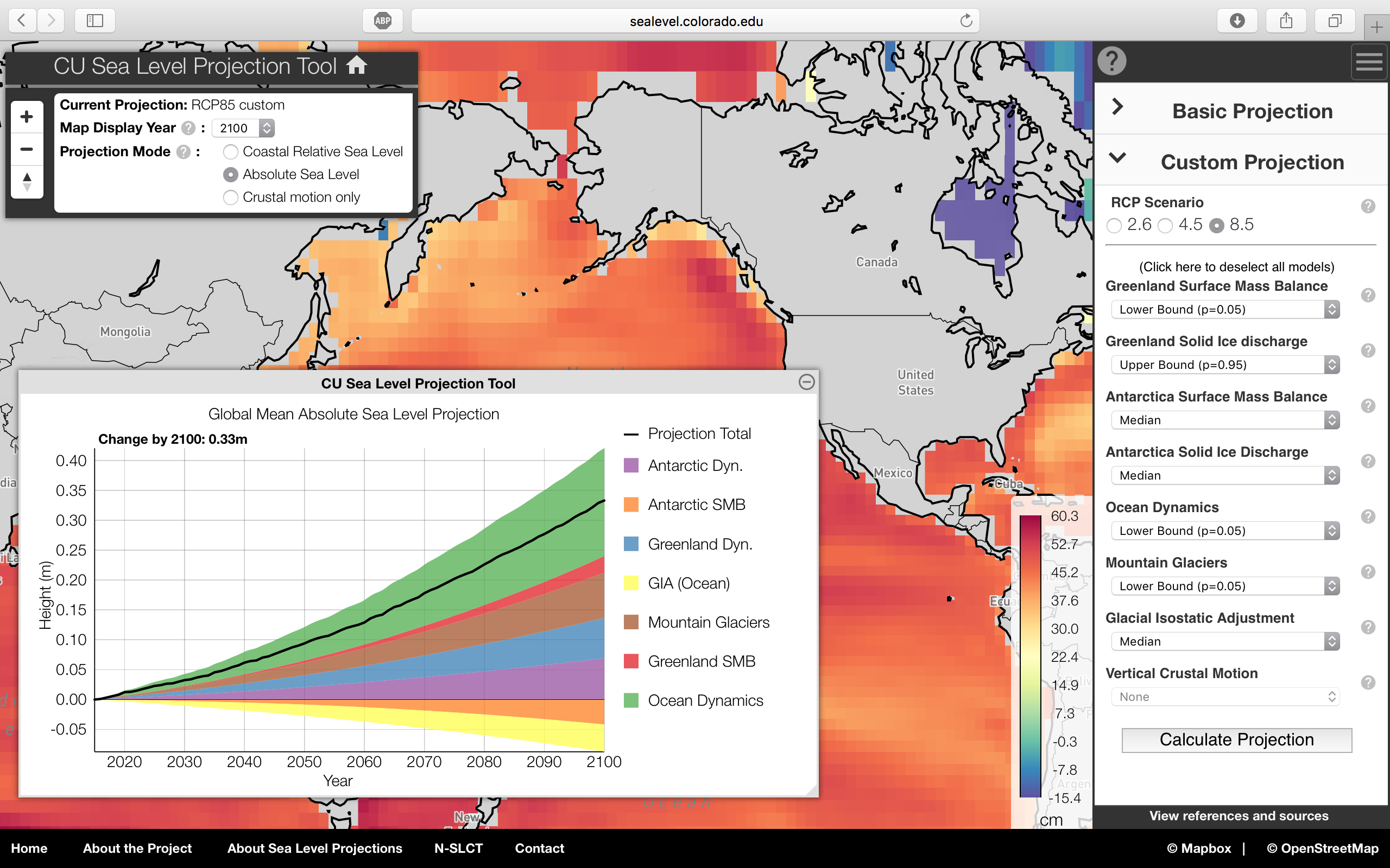
Sea Level Projection Tool
While at the University of Colorado, and in conjunction with the NASA Sea Level Change Team, I developed the Sea Level Projection Tool project. The project's aim is to provide a platform for bringing together sea level projection models from various disciplines within the scientific community. The project also aims to give coastal communities an easy way to interface with the most recent sea level projections.
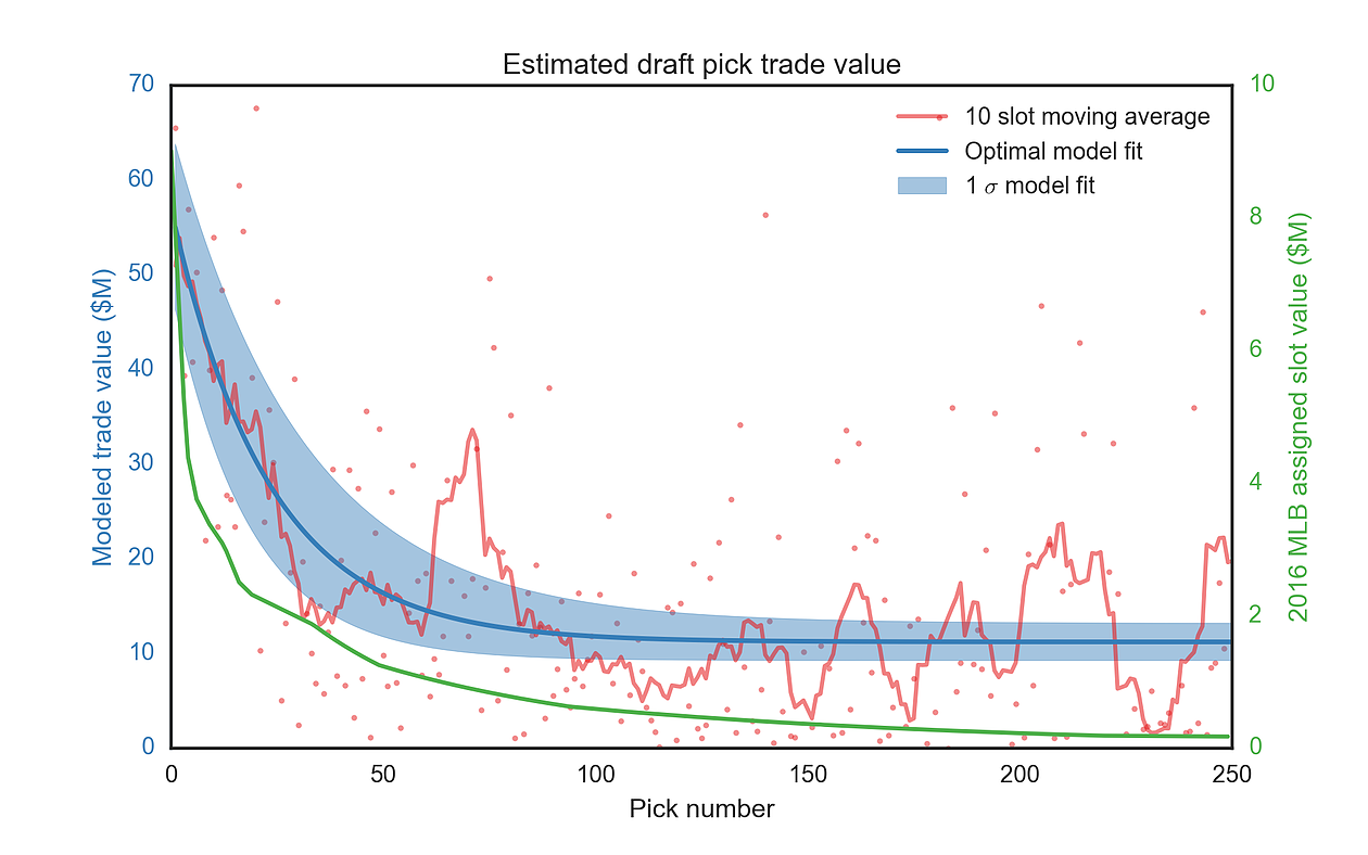
MLB Draft Pick Trade Value
My good friend Hank and I developed a model to predict the trade value of players in the MLB draft. We were finalists in the Colorado Rockies 2016 case competition and presented to the Rockies' front office at Coors Field.